Logo -- Cascade Ridge
 

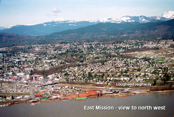
Aerial Photograph # 7 - Mission east side View

East Mission


Mission - East side of downtown. Stave Lake Road runs up hill from Lougheed Highway - foreground right.
Air Photo #1
Air Photo #2
Air Photo #3
airplane Air Photo #4
Air Photo #5
Air Photo #6
airplane Air Photo #7
Air Photo #8
Air Photo #9
airplane Air Photo #10
Air Photo #11

Aerial Photo Imagemap... click an arrow or select link above. Air Photo of East over Hatzic Air Photo of Mission, BC west side Air Photo of Mission, BC commercial areas Air Photo East from Mission, BC downtown Air Photo Mission, BC east side Air Photo over Hatzic up Hatzic Valley Air Photo over Hatzic Lake Air Photo of Cascade Ridge - 2.5 acre home sites for sale Air Photo of Cascade Ridge - 2.5 acre home sites for sale Air Photo of Cascade Ridge - 2.5 acre home sites for sale Air Photo of Cascade Ridge - 2.5 acre home sites for sale